Hiking the Tongariro Alpine Crossing in New Zealand
During my spring break in 2019, while studying abroad in Australia, I went on a solo backpacking trip to the North Island of New Zealand. I bought a pass for a hop-on/hop-off charter bus and spent a day at each location, beginning in Auckland then heading south. One of the highlights of my trip was being able to experience the famed Tongariro Alpine Crossing. I woke up at 4:30 AM to catch a shuttle that dropped me off at the entrance of the trail. The hike was 11 miles and possibly the most peaceful day of my life–despite the heat and harsh terrain. I was lucky enough to catch the sunrise just as it began peaking over the mountain tops and it was absolutely breathtaking. For about 8-9 hours (with no cell service), I was free of all distractions and walked in silence– hearing only the sound of my breathing and footsteps on the ground. When I stopped to eat my lunch at the peak of the first mountain, I looked down at a valley below me in amazement that the world could be so beautiful. As an avid National Geographic fan, I’ve seen countless nature documentaries and captivating photographs of stunning locations, but none of it ever felt real until I saw it for myself right there on that mountaintop. Below me, there were two lakes, both equally beautiful: one a striking emerald green, and the other crystal blue; in the distance, I could see miles and miles of New Zealand landscape untouched by man–a foreign experience for an American like myself. (Fun fact: only 14% of U.S. land is protected, while NZ has 36%.)
These photos memorialize one of the happiest days of my life and now, I’m sharing them with you. Although they bring back the memories, these photos could never truly capture exactly what it was like to be at this place, at this time.

The entrance to the Tongariro Alpine Crossing trail.
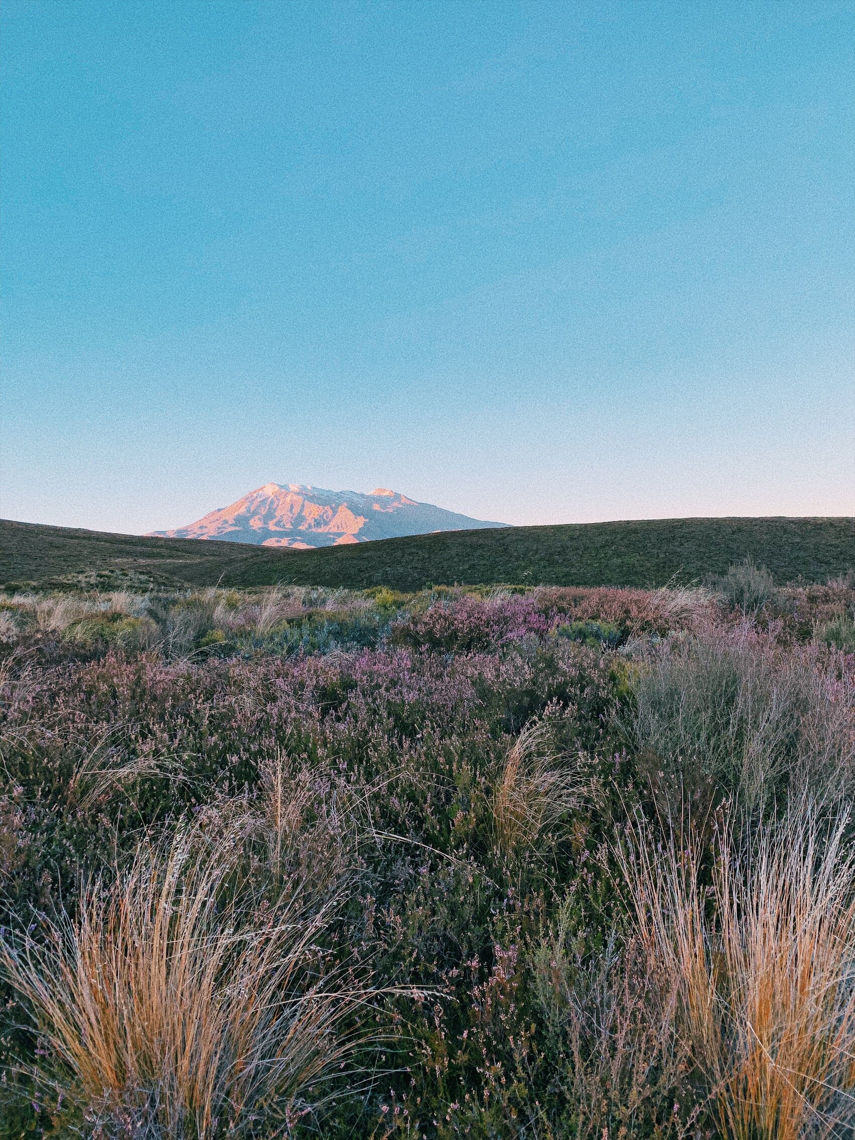
A beautiful sunrise illuminating Mount Ruapehu, an active stratovolcano.

Mount Ngauruhoe, an active volcano, and a dried out crater lake at its base.

View of one of the two Emerald Lakes from the summit of Mount Tongariro.

The other Emerald Lake, seen from the summit of Mount Tongariro.

View from the peak of Mount Tongariro. The high altitude of the mountain made the clouds in the distance appear to be low-lying, but they were not.
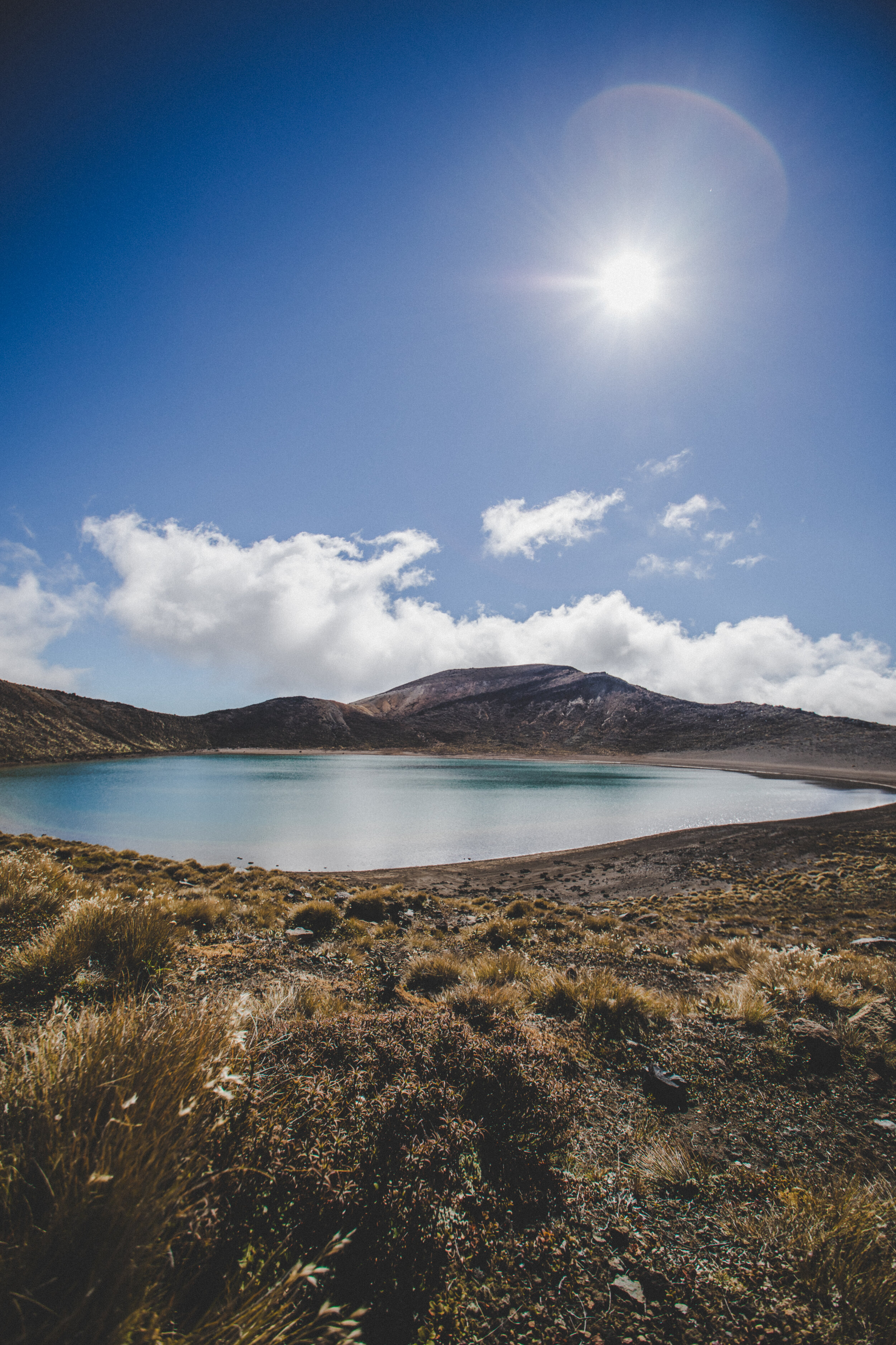
Blue Lake at the base of Mount Tongariro.

Blue Lake.
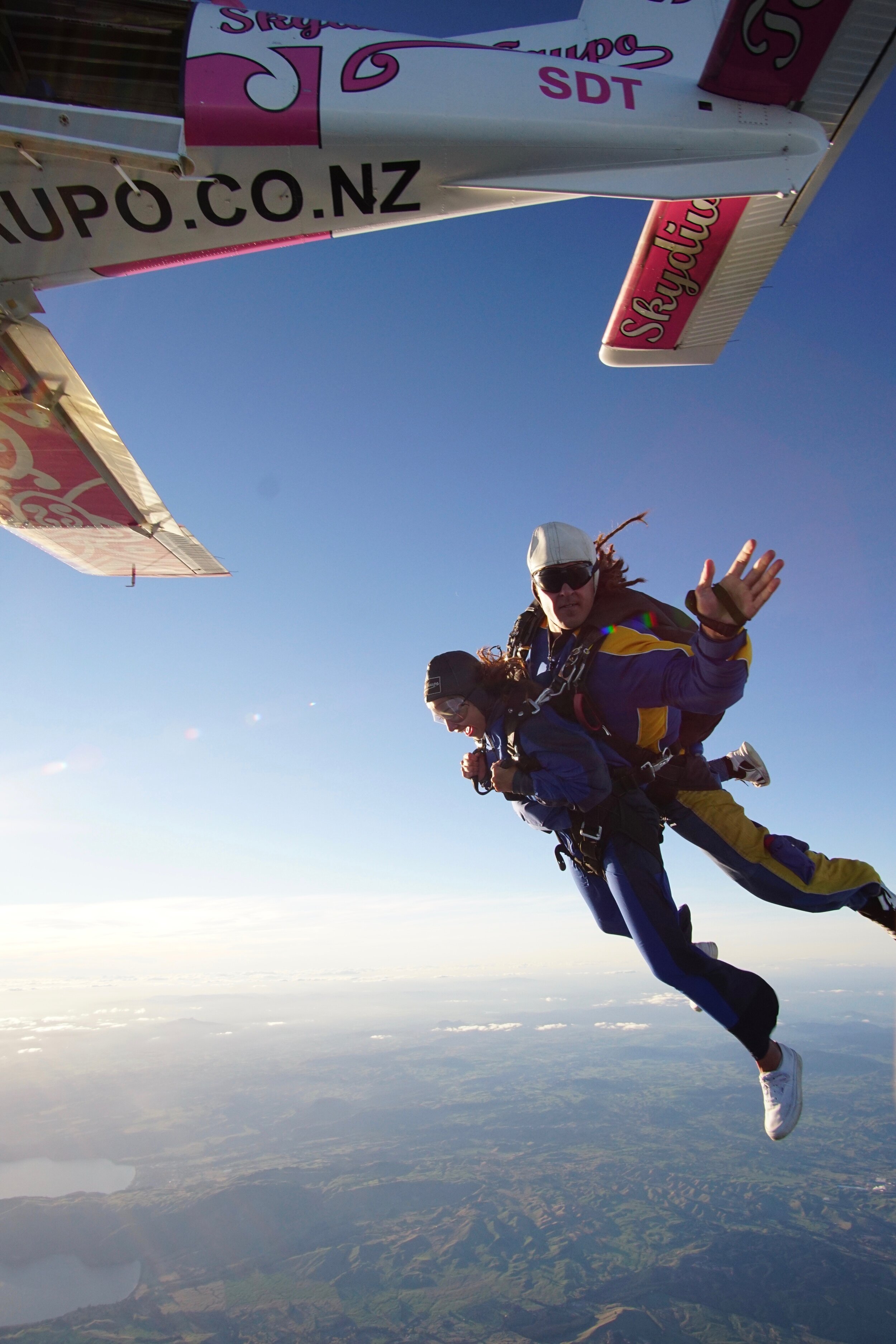
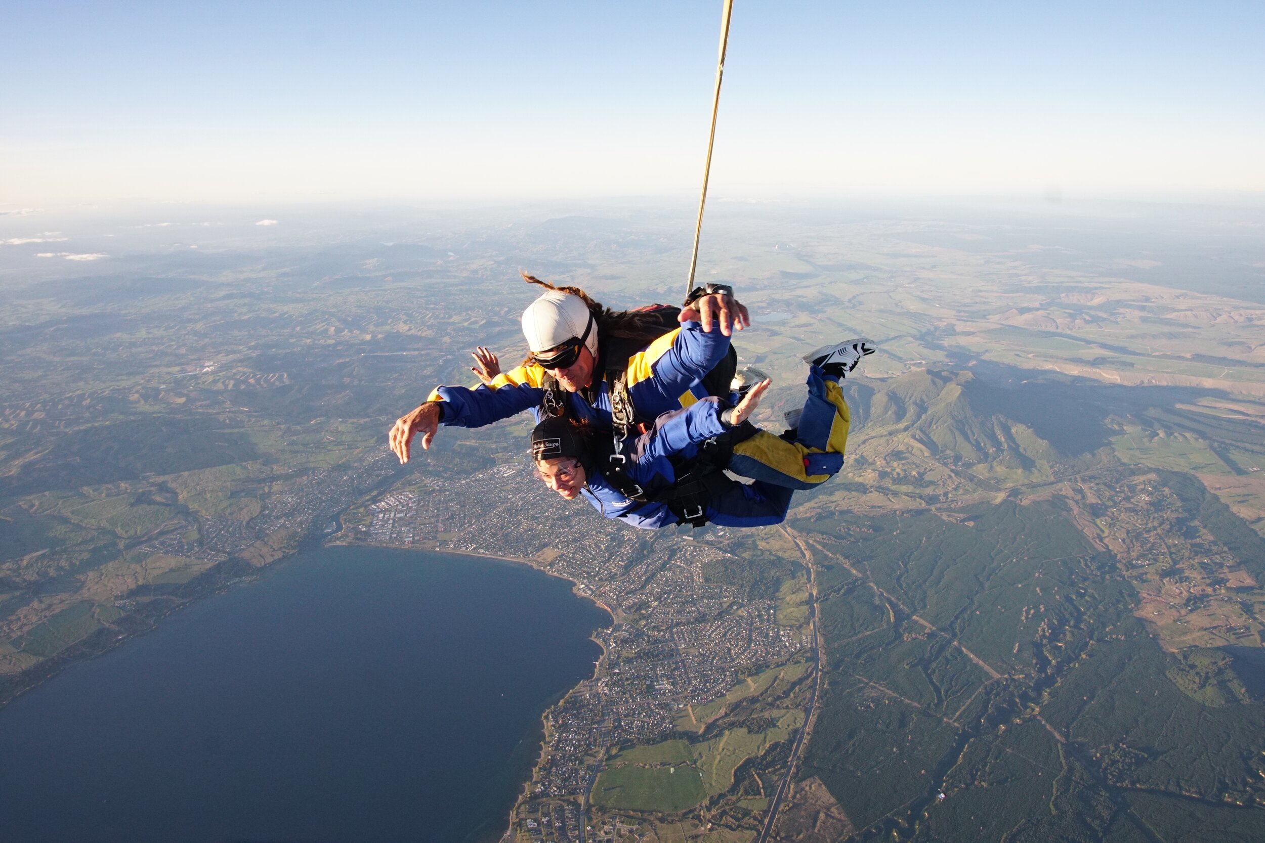
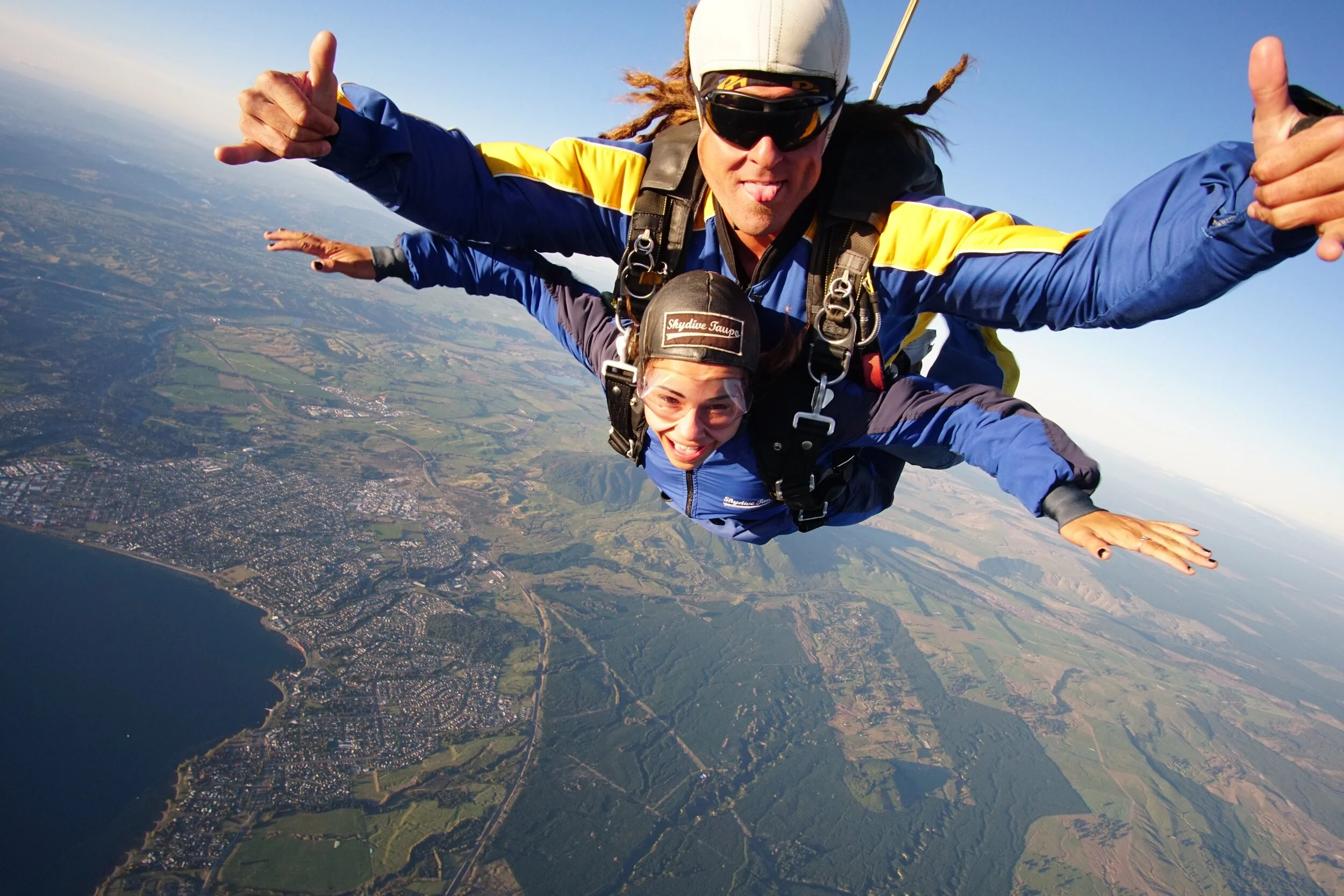
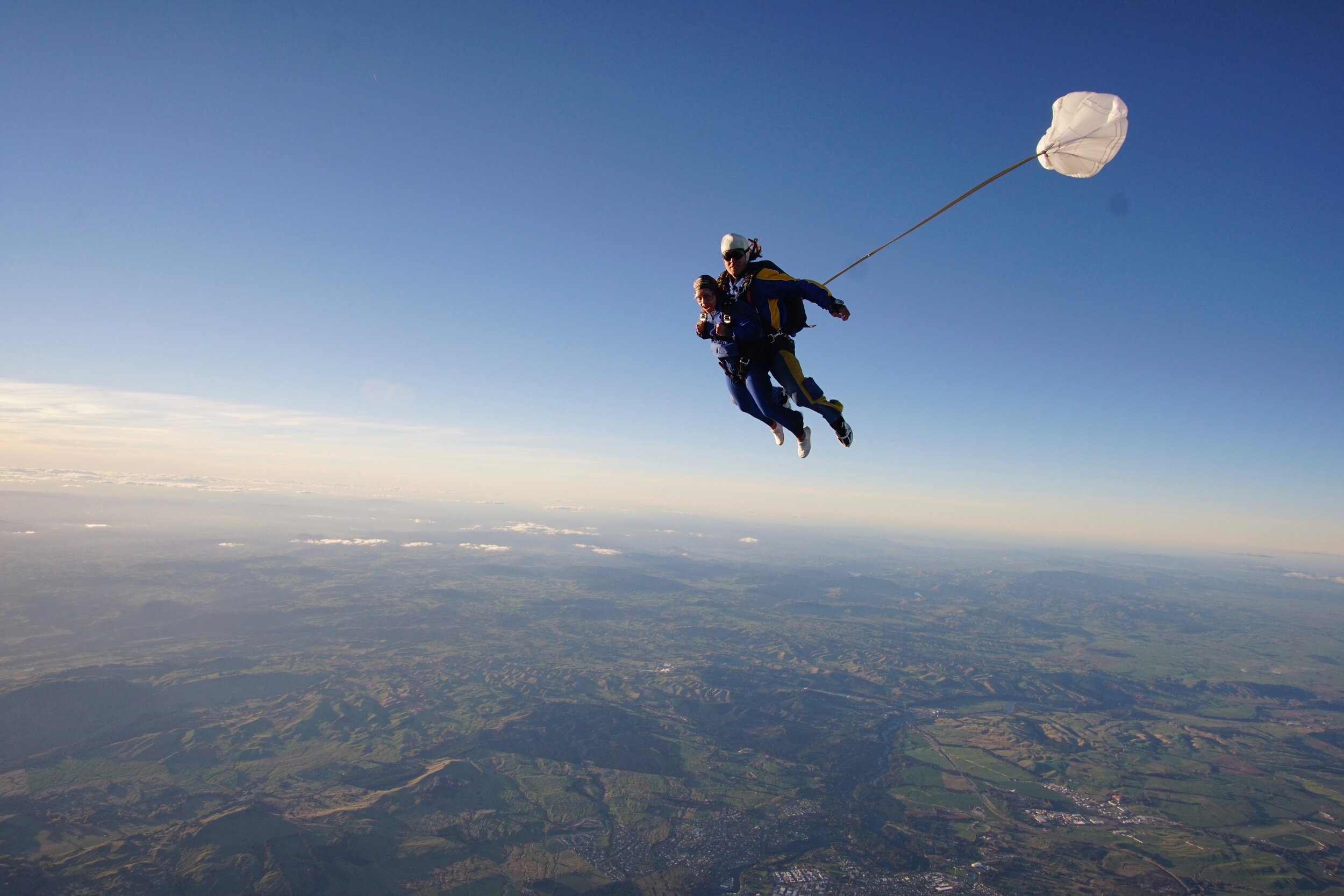
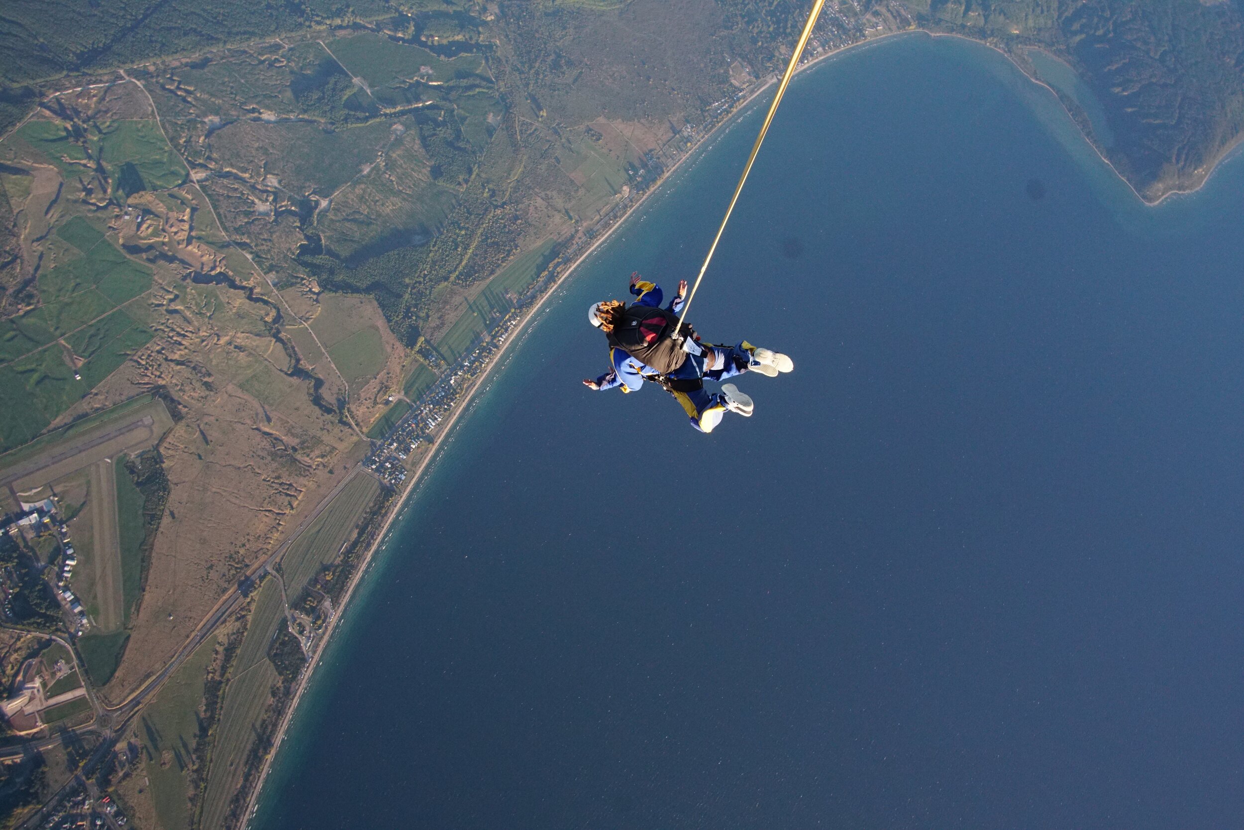
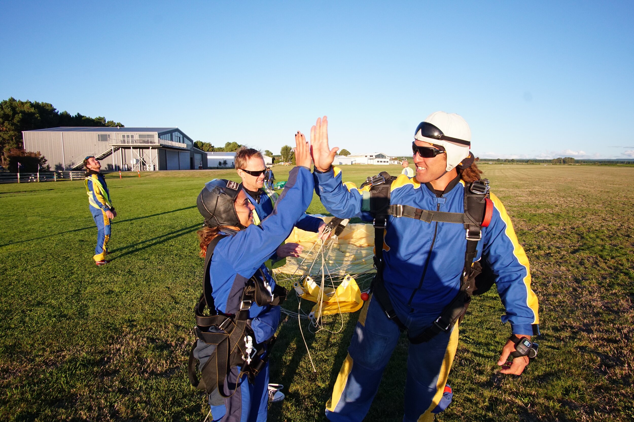
After I finished my hike, the shuttle picked me up and dropped me off at a nearby skydiving facility. It was a very spontaneous decision that was both exciting and terrifying at the same time, but I had always wanted to go skydiving so I took a chance. I never pictured my first time being in a foreign country completely alone but in hindsight, I have no regrets. I got to see the Crossing up close AND from the sky, and dove over Lake Taupo, the biggest lake in NZ–so it was an amazing day, to say the least. Of course, I didn’t take these photos but here they are anyway. :)
P.S. Biig shoutout to my amazing (and funny) instructor, Joe.